Publisher description
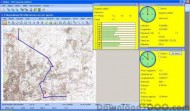
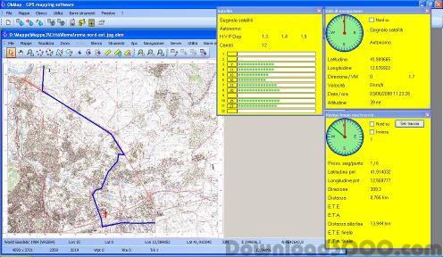
OkMap is a free software for many outdoor activities: - Trekking - Off road - Mountain bike - Sailing - Hunting and fishing - Finding mushrooms - Soft air - Geocaching - And many others... OkMap help you to: - Calibrate raster maps with different types of projections - Create own digital maps drawing point, multipoint, polyline and polygon - Display simultaneously raster and vectorial maps - Import vectorial data with different types of cartographic projections - Use raster and vectorial maps as background for navigation - Create and manage waypoints, routes and tracks in GPX format - Use digital terrain models to display the elevation - Upload and download data to and from a GPS device (Garmin and Magellan) - Navigate in real time with a GPS device through NMEA protocol - Display Google Earth and Google Maps in current map location - Exchange data with Google Earth and view your map in 3D - Find nearby cache in geocaching.com web site - Exchange data with gpsgate.com server - Receive customized navigation data from remote GPS devices - Send the current position to an OkMap remote server - Make conversions between different types of coordinates, datums, formats, etc.. - Use a handy calculator for your calculations - Many other things... Supported languages: - English - Italian Supported formats: - Images: ecw, bmp, gif, jpg, png, tif and many others - Maps: gfw, jgw, pgw, tfw, bpw (Drg maps); ecw (Earth Resource Mapping); map (OziExplorer); gmi (GpsTuner) - Vector data: shp, dbf (Esri shape file); dcw (Digital Chart of World) - GPS data: gpx (GPS Exchange Format); kml (Keyhole Markup Language); wpt, plt, rte (OziExplorer); loc (Geocaching) and many others formats thanks to the software GpsBabel - DEM data (digital earth model): hgt (SRTM-1 and SRTM-3)
Related Programs
Algolab Raster to Vector Conversion CAD/GIS SDK 2.55
CAD/CAM/GIS software development kit
Algolab Raster to Vector Conversion Toolkit 2.97.72
Converts line artwork from raster to vector

astral projection 1.02
Astral Projection product review application
Datum Locker 0.1.13
Cryptographic Note and Login Storage Utility
Magellan Explorer 3.32
File manager /w FTP, viewer and archiver